Drone Substation Inspection
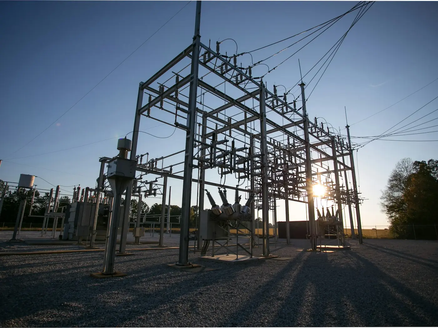
Substation thermography is normally done from the ground, which means it is done from wherever a person can safely stand. A great deal of the plant that fails is not visible from there.
- Free to post
- No commission on the job
- Part 107 certified pilots



118 inspection pilots ready to quoteAcross 37 states & regions
Angles the ground cannot give you
Bus connections, the tops of bushings, arrester terminations and transformer radiators read very differently from above than from behind a fence at ground level. The obstructed view is where the missed defects are.
Radiometric, referenced to a phase
A usable substation report states a rise over ambient and over the equivalent healthy phase. That needs temperature per pixel and a recorded load, not a colourful screenshot.
Distance from energised plant
Aerial survey keeps people further from live apparatus than a ground thermographer walking the yard, which is the argument that usually gets these programmes through a safety review.
Free to post
Posting and receiving quotes costs nothing, and SkyLog takes no commission and adds no markup. You pay the pilot you hire, at the price the two of you agree.
What this settles
- Transformer bushings, terminations and radiator banks, plus oil level and visible leakage.
- Bus connections, clamps and jumpers — where a large share of thermal findings sit — along with breakers, disconnects, CTs, VTs and surge arresters.
- Cable terminations, insulator condition, steelwork and coating, control building roof, fence and perimeter.
- Vegetation encroachment and evidence of animal or bird intrusion, a common outage cause and easy to see from above.
What it does not
- Find a developing fault on a lightly loaded yard. Survey under meaningful load, ideally near seasonal peak.
- Produce an actionable severity without the load at capture recorded alongside it.
- Set its own schedule. Minimum approach distances, escorts, switching procedures and security approval are yours, not the aircraft's.
- Overfly whatever it likes — some operators restrict flight over transformers or require a tethered aircraft.
State your clearance and approach rules in the post rather than discovering the mismatch on the day. A pilot who asks about switching procedures at quote stage has done this before.
How it works
Three steps, no account needed to start, and nothing to pay at any point in it.
- 1
Describe the job
The form opens with this page's answers already filled in — service, deliverable, site access. Add the location and anything specific to your site.
- 2
Pilots quote it
Every pilot whose service area and services match is notified. You get itemised quotes back with their credentials, kit and sample work attached.
- 3
Compare and hire
Pick on price, proximity or portfolio, and pay the pilot directly. SkyLog takes no cut and adds no markup to what you agree.
Inspection pilots with published profiles
Real published profiles. Open any one to see credentials, kit, service area and sample work before you post.
 chris aldridge
Texas, United States
20 work samples
I’m a commercial drone pilot providing aerial mapping, property line overlays, topographic mapping, construction site data, radiometric thermal inspections, 3D modeling, real estate listing photography and video, property marketing, and professional aerial imagery for businesses and landowners.
Real estateWeddingEventInspectionMapping / surveyFilm / TVConstructionOther- George Benes

Oregon, United States
13 work samples
I've been a Part 107 drone pilot since 2019, working with Pacific Northwest clients on Real estate, construction progress, mapping, telecom inspections, architectural photography and events. I am very flexible and can provide deliverables within 24 - 48 hours. I take great pride in my work and having a photography business, my delivered photos are edited and culled to the best of the best. I worked for 30+ years as a commercial construction Superintendent, managing multi-million dollar construction projects and this experience allows me to be very safety oriented and knowledgeable on construction sites, providing the construction companies with usable deliverables that they can share with all stakeholders involved in their building project.
Real estateEventInspectionMapping / surveyConstruction  Andy Jones
California, United States
12 work samples
FAA Part 107 Certified Remote Pilot based in Southern California, specializing in construction documentation, infrastructure inspections, mapping, orthomosaics, and aerial imagery. With more than two decades of experience managing complex federal construction projects, I understand the importance of accuracy, safety, and delivering actionable data—not just photos. I operate professional DJI Enterprise aircraft, including the DJI Matrice 4E, DJI Matrice 4T, as well as the DJI Air 3S for high-resolution imaging and the DJI Neo 2 for specialized close-range operations. My services include construction progress documentation, roof and property inspections, land development, infrastructure photography, photogrammetry, mapping, and custom aerial imaging. I also conduct search operations for lost pets using aerial search techniques and thermal imaging. Every mission is conducted in compliance with FAA regulations, with careful mission planning, clear communication, and a commitment to delivering high-quality results on schedule. Whether you need a single inspection or recurring project documentation, my goal is to provide reliable aerial data you can confidently use to make decisions.
Real estateEventInspectionMapping / surveyConstructionAgricultureOtherFilm / TVWedding George Colonna
Maryland, United States
12 work samples
Started flying drones for General Dynamics Robotics Systems in 2009 as the subject matter expert and lead test engineer for RCTA and a program called the Soldier Machine Interface. We developed leader/follower code for up-armored autonomous assets a full decade before Google fielded their driverless car "train" and a UI that let soldiers/marines plan missions on the ground and in the air. My job was to ensure the software worked, more importantly, met customer requirements. Working in the field afforded me a wealth of experience regarding process and implementation, but also how to think critically and resolve issues on the fly. If interested in learning more about my credentials, please see my website. My current fleet is primarily DJI and Autel. I have RTK capability and a complete field kit to sustain remote operations for several days.
InspectionMapping / surveyConstructionOtherFilm / TV- K Enagonio

Tennessee, United States
10 work samples
I've been flying since 2015 and specialize in both cinematic filmmaking as well as surveying, construction, sensitive infrastructure capture, and music videos and events.
Film / TVConstructionInspectionEventAgricultureReal estateMapping / surveyOther  Casey Jones
Arizona, United States
9 work samples
FAA Part 107 commercial drone pilot specializing in RTK mapping, aerial photography, thermal imaging, property documentation, construction progress, and detailed site capture. I operate professional DJI aircraft including the Matrice 4E and Matrice 4T, with RTK capability for repeatable, high-quality data collection. I approach each assignment as a complete mission, from airspace and site planning through safe flight operations, field verification, data handling, and final delivery. I serve clients throughout the California, Nevada, and Arizona tri-state region and am available for both individual assignments and multi-site projects.
Real estateEventMapping / surveyConstructionAgricultureOtherInspection
Inspection pilots by state
Load is not a detail, it is the method
A thermal camera finds a defective connection because current flowing through added resistance generates heat. On a lightly loaded yard the same defect sits close to ambient and is invisible, so a survey flown at three in the morning on a quiet feeder can pass a substation that is genuinely developing a fault. Survey under meaningful load, ideally close to seasonal peak, and record the load at the time of capture — because a given temperature rise means one thing at a quarter of rating and something much more urgent at ninety percent. Any severity classification that does not state the load it was measured at cannot be acted on or compared against the next survey.
What gets surveyed
Transformer bushings, terminations and radiator banks, plus oil level and any visible leakage. Bus connections, clamps and jumpers, which are where a large share of thermal findings sit. Circuit breakers, disconnect switches and their contacts. Current and voltage transformers. Surge arresters. Cable terminations and the condition of insulators. Then the structural and housekeeping side: steelwork and coating, the state of the control building roof, fence and perimeter condition, vegetation encroaching on the yard, and evidence of animal or bird intrusion, which is a common outage cause and easy to see from above. On many sites the same flight is also used to document the yard layout as a record.
Site rules will set the schedule
The aviation side is straightforward. Everything else is yours. Expect minimum approach distances to energised apparatus that are set by your standards rather than by the aircraft's capability, an escort requirement, a switching or clearance procedure if anything needs to be de-energised, site-specific security approval, and possibly a restriction on flying directly over certain plant. Some operators require a tethered aircraft or a hard limit on overflight of transformers. None of this is a reason not to do it; all of it is a reason to state your rules in the post rather than discovering the mismatch on the day. A pilot who asks about clearance procedures at quote stage has done this before.
What a report has to contain to be actionable
Each finding located precisely enough to send a crew to — equipment identifier, phase, and the specific component, not just "transformer bay 3". Radiometric imagery for each finding, with the reference point used. The measured rise, both over ambient and over the comparable healthy phase. Load at capture. A severity classification against a stated scale, with the recommended timescale attached. A matching visual image of each finding, because roughly half of what thermal flags is explained by something visible — sunlight on a surface, a recently operated switch, a reflection. And the survey conditions: sky, ambient temperature, wind. Without those a later reviewer cannot judge whether the survey was capable of finding what it claims to have ruled out.
Common questions
Does the substation need to stay energised?
For thermal work, yes, and ideally under real load — a de-energised yard shows nothing thermally. For structural and housekeeping documentation it makes no difference to the imagery, though it changes which site rules apply.
Is it safe to fly over live apparatus?
It is done routinely, but the governing rules are your own minimum approach distances and overflight policy rather than aviation regulations. Some operators restrict flight directly above transformers or require a tether. State your rules in the post.
How much does it cost?
It scales with the size of the yard, how much plant is in scope and the reporting depth. Inspection quotes on SkyLog have ranged $100 to about $1,550 with a $300 median across 13 quotes spanning all inspection types — a full substation thermal survey with an interpreted report sits above the middle. Post the site for real numbers.
Do we need a certified thermographer?
For imagery, no. For a report that classifies severity and drives maintenance spend, it is a fair thing to require — ask for Level I or Level II thermography certification and ask who is signing the interpretation, which may not be the pilot.
Can this replace our ground thermography?
It complements it more often than it replaces it. Aerial reaches the obstructed and elevated views; ground work gets closer to some plant and can be combined with other testing. Several operators do aerial annually and ground work alongside other maintenance.
Can one visit cover several substations?
Yes, and it prices much better that way. Post the group with the site list rather than one substation at a time.
Related drone services
Post your substation survey free
Give the voltage class, the site count and your clearance rules. Pilots with thermal payloads quote directly.
- No commission, ever
- Part 107 certified pilots
- No obligation to hire
Prices and guidance on this page were last reviewed .