Drone Bridge Inspection
The expensive part of a bridge inspection has never been the looking. It is the snooper truck, the lane closure and the traffic management that make the looking possible — and that is the part a drone removes.
- Free to post
- No commission on the job
- Part 107 certified pilots


118 inspection pilots ready to quoteAcross 37 states & regions
The soffit without the snooper
Undersides, bearings and pier caps are the hardest surfaces to reach and among the most informative. Reaching them from below rather than from an under-bridge unit changes the cost of looking by an order of magnitude.
Fewer closures, more frequent looks
When an inspection no longer requires shutting a lane, it stops competing with traffic management budgets — which in practice means the structure can be looked at between scheduled inspections rather than only during them.
A comparable record
Element-level photography captured the same way each cycle lets deterioration be tracked rather than re-described. Ask for repeatable positions from the first survey and the second one is worth twice as much.
Free to post
Posting and receiving quotes costs nothing, and SkyLog takes no commission and adds no markup. You pay the pilot you hire, at the price the two of you agree.
What this settles
- Deck surface and joints from above; soffit, girders, diaphragms and stiffeners from below — the surfaces carrying most of the diagnostic information.
- Bearings and bearing seats, pier caps, columns, abutments and wingwalls.
- Scour indicators and waterline debris, which are frequently why a structure is being looked at out of cycle.
- Thermal on concrete, where subsurface delamination often shows as an anomaly before it is visible.
What it does not
- Satisfy hands-on examination. For fracture-critical members, hands-on means within arm's reach, and a photograph is not that.
- Change any regulatory inspection requirement. The qualified inspector responsible should specify what is captured.
- Hold station under a deck on satellite positioning alone — that needs visual positioning, obstacle sensing and real manual skill.
- Suit a generalist. Over water there is no forced-landing option worth the name, and wind funnels around a structure unpredictably.
It supplies condition evidence for routine visual inspection, targets where hands-on effort is spent, and documents conditions after an impact or flood without waiting for equipment.
How it works
Three steps, no account needed to start, and nothing to pay at any point in it.
- 1
Describe the job
The form opens with this page's answers already filled in — service, deliverable, site access. Add the location and anything specific to your site.
- 2
Pilots quote it
Every pilot whose service area and services match is notified. You get itemised quotes back with their credentials, kit and sample work attached.
- 3
Compare and hire
Pick on price, proximity or portfolio, and pay the pilot directly. SkyLog takes no cut and adds no markup to what you agree.
Inspection pilots with published profiles
Real published profiles. Open any one to see credentials, kit, service area and sample work before you post.
 Nick Bowen
Oklahoma, United States
3 work samples
CreekBridge Media is fully Part 107 Licensed with the FAA for Commercial Drone Services and Insured for everybody's protection. All flights are thoroughly researched and planned out in advance, and all flight data is logged and archived via AirData UAV. CreekBridge media follows FAA 14 CFR Part 107 regulations for small Unmanned Aircraft Systems (sUAS) and reserves the right to deny services that are unsafe or in violation of Part 107 regulations. CreekBridge Media specializes in Real Estate, Roof Inspection, General Photography and Videography including editing.
Real estateInspectionWeddingEventConstructionOtherFilm / TV Tanner Scholten
Washington, United States
10 work samples
I am a professional photographer and commercial remote pilot (FAA Part 107) based in Kirkland, serving Western Washington and beyond (including most of Washington, and Oregon as needed). By pairing my skills as a photographer with the unique data types and perspectives of aerial capture, I bridge the gap between technical data collection and polished visuals. My flight experience centers on technical aerial data—including multi-site agricultural monitoring and extensive, high-resolution orthomosaic mapping—alongside clean, publication-grade commercial real estate and event media.
Mapping / surveyReal estateEventWeddingConstructionAgricultureOther chris aldridge
Texas, United States
20 work samples
I’m a commercial drone pilot providing aerial mapping, property line overlays, topographic mapping, construction site data, radiometric thermal inspections, 3D modeling, real estate listing photography and video, property marketing, and professional aerial imagery for businesses and landowners.
Real estateWeddingEventInspectionMapping / surveyFilm / TVConstructionOther- George Benes

Oregon, United States
13 work samples
I've been a Part 107 drone pilot since 2019, working with Pacific Northwest clients on Real estate, construction progress, mapping, telecom inspections, architectural photography and events. I am very flexible and can provide deliverables within 24 - 48 hours. I take great pride in my work and having a photography business, my delivered photos are edited and culled to the best of the best. I worked for 30+ years as a commercial construction Superintendent, managing multi-million dollar construction projects and this experience allows me to be very safety oriented and knowledgeable on construction sites, providing the construction companies with usable deliverables that they can share with all stakeholders involved in their building project.
Real estateEventInspectionMapping / surveyConstruction  Andy Jones
California, United States
12 work samples
FAA Part 107 Certified Remote Pilot based in Southern California, specializing in construction documentation, infrastructure inspections, mapping, orthomosaics, and aerial imagery. With more than two decades of experience managing complex federal construction projects, I understand the importance of accuracy, safety, and delivering actionable data—not just photos. I operate professional DJI Enterprise aircraft, including the DJI Matrice 4E, DJI Matrice 4T, as well as the DJI Air 3S for high-resolution imaging and the DJI Neo 2 for specialized close-range operations. My services include construction progress documentation, roof and property inspections, land development, infrastructure photography, photogrammetry, mapping, and custom aerial imaging. I also conduct search operations for lost pets using aerial search techniques and thermal imaging. Every mission is conducted in compliance with FAA regulations, with careful mission planning, clear communication, and a commitment to delivering high-quality results on schedule. Whether you need a single inspection or recurring project documentation, my goal is to provide reliable aerial data you can confidently use to make decisions.
Real estateEventInspectionMapping / surveyConstructionAgricultureOtherFilm / TVWedding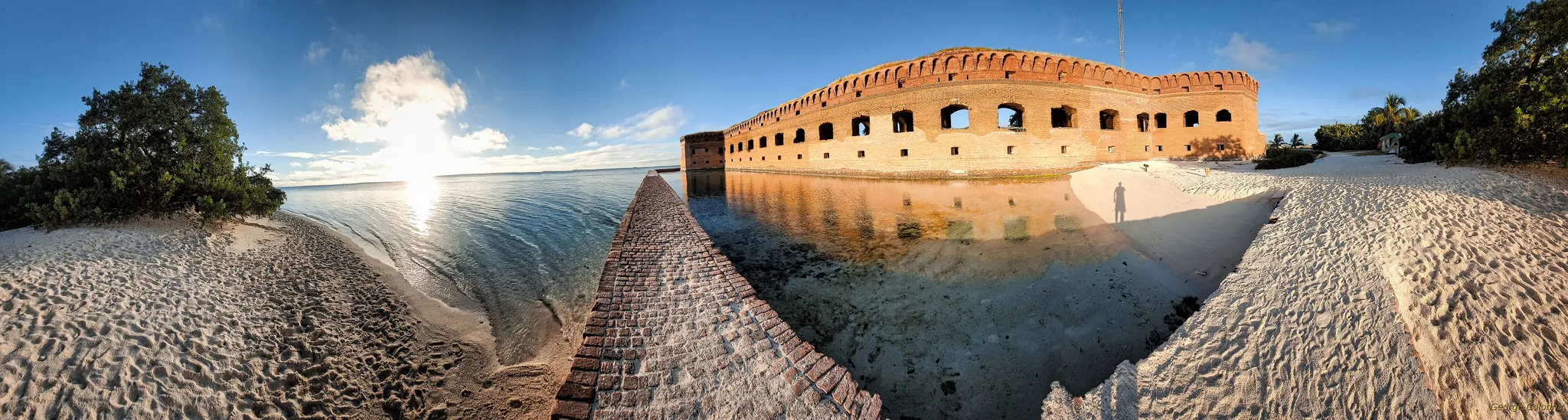 George Colonna
Maryland, United States
12 work samples
Started flying drones for General Dynamics Robotics Systems in 2009 as the subject matter expert and lead test engineer for RCTA and a program called the Soldier Machine Interface. We developed leader/follower code for up-armored autonomous assets a full decade before Google fielded their driverless car "train" and a UI that let soldiers/marines plan missions on the ground and in the air. My job was to ensure the software worked, more importantly, met customer requirements. Working in the field afforded me a wealth of experience regarding process and implementation, but also how to think critically and resolve issues on the fly. If interested in learning more about my credentials, please see my website. My current fleet is primarily DJI and Autel. I have RTK capability and a complete field kit to sustain remote operations for several days.
InspectionMapping / surveyConstructionOtherFilm / TV
Inspection pilots by state
What the survey covers
Deck surface and joints from above. The soffit, girders, diaphragms and stiffeners from below — the surfaces that carry most of the diagnostic information and are hardest to reach. Bearings and bearing seats. Pier caps, columns, abutments and wingwalls. Scour indicators and debris at the waterline, which are frequently the reason a structure is being looked at out of cycle. Parapets, barriers and drainage. On steel structures, coating condition and corrosion, with particular attention to connections and to anywhere water sits. On concrete, cracking with its orientation and width where resolvable, spalling, delamination staining, efflorescence and exposed reinforcement. Thermal adds a genuinely useful layer on concrete, since subsurface delamination often shows as a thermal anomaly before it is visible.
Where hands-on inspection is still required
This needs stating plainly, because it is the question every agency asks first. Regulatory inspection regimes specify what must be inspected, how often, by whom, and what constitutes hands-on examination — for fracture-critical members and for certain conditions, hands-on means within arm's reach, and a photograph is not that. Aerial capture does not change those requirements. What it does is supply high-quality condition evidence for routine visual inspection, target where hands-on effort is spent, provide access to surfaces that would otherwise go unexamined between cycles, and document conditions after an impact or a flood without waiting for equipment. If the survey feeds a regulated inspection, the qualified inspector responsible for that inspection should specify what is captured — their requirements govern, not the pilot's preferences.
The flying is harder than it looks
Under a deck there is no GPS, and an aircraft relying on satellite positioning will not hold station there. That is why this work needs pilots with the right equipment and practice — visual positioning systems, obstacle sensing, and the manual skill to fly in a confined space with a structure above and water or traffic below. Over water there is no forced-landing option worth the name. Wind funnels through and around a structure in ways that are not obvious from the bank. And most bridges sit over or beside live traffic, which brings its own permissions. None of this makes the work exotic; it does make it a poor fit for a generalist, and it is worth asking directly what a pilot has flown under.
Specifying it
State the span, the structure type and the material, and say what is under it — water, road, rail — because that decides the permissions. Name the elements you need covered and the smallest defect that must be resolvable, since that sets standoff distance and flight time. Say whether thermal is wanted for delamination screening. Say whether the deliverable is an image set indexed by element, a photogrammetric model, or an inspection report — and if a report, who is signing it, because that may need to be a qualified inspector rather than the pilot. Flag whether a lane or channel closure is available, and whether any part of the structure has been previously flagged, so the pilot can plan the detail passes rather than discovering them.
Common questions
Can a drone replace a regulated bridge inspection?
No. Inspection regimes set requirements about frequency, qualified personnel and hands-on examination that aerial capture does not satisfy on its own. It is used to support and target those inspections, and to look at the structure between them.
Can it fly under the deck?
With the right aircraft and pilot, yes — but it is GPS-denied flight in a confined space, which needs visual positioning, obstacle sensing and real practice. Ask specifically what a pilot has flown under before, not just whether they can.
How much does it cost?
It scales with span, the number of elements and the site's traffic constraints. Inspection quotes on SkyLog have ranged $100 to about $1,550 with a $300 median from 13 quotes across all inspection types; a multi-span bridge sits well above the middle of that. Post the structure for real numbers.
Do we need a lane closure?
Usually far less than with an under-bridge unit, and sometimes none. Launch and recovery still need a safe area, and flight over live traffic has its own considerations, so expect some coordination even where a full closure is avoided.
Does thermal help on a bridge?
On concrete, yes — subsurface delamination often shows thermally before it is visible, which makes it a useful screening layer. It needs the right conditions, typically solar loading followed by the right window, so it constrains timing.
Can we survey several structures in one visit?
Yes, and for an agency with a portfolio that is the efficient way to do it. Post the group rather than one bridge; the per-structure price falls considerably.
Related drone services
Post your bridge inspection free
Give the structure type, span and what sits underneath. Pilots with confined-space experience will quote directly.
- No commission, ever
- Part 107 certified pilots
- No obligation to hire
Prices and guidance on this page were last reviewed .