Drone Construction Progress Photos
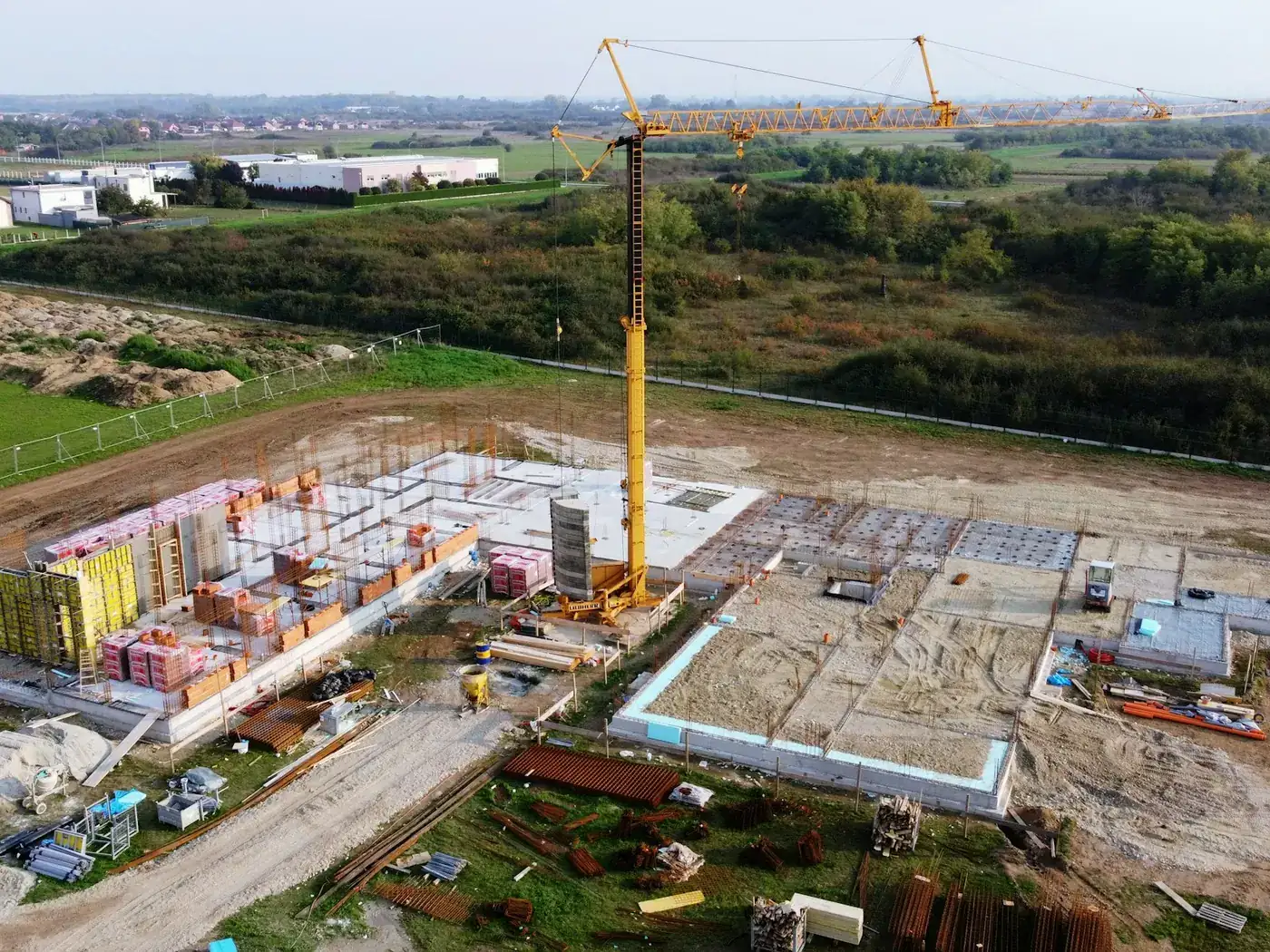
The value is not in any single flight. It is in flying the same site from the same positions on a regular cadence, so that twelve visits become a record you can scrub through rather than twelve unrelated photo sets.
- Free to post
- No commission on the job
- Part 107 certified pilots

110 construction pilots ready to quoteAcross 36 states & regions
Repeatable vantage points
Agree a set of positions and altitudes on the first visit and fly them every time. Identical framing month to month is what makes two images comparable, and it costs nothing to set up if it is decided at the start.
The record that settles arguments
Dated aerial imagery of what was on site and when is the cheapest documentation a project can hold. Most of the time nobody looks at it; when there is a dispute about sequence or conditions, it is the only version nobody wrote afterwards.
Priced per visit, not per project
Recurring work is normally quoted per visit at a lower rate than a one-off, because the pilot is not re-planning the site each time. Say the cadence and the duration when you post and you will be quoted on that basis.
Free to post
Posting and receiving quotes costs nothing, and SkyLog takes no commission and adds no markup. You pay the pilot you hire, at the price the two of you agree.
What a recurring run gives you
- The same four corner obliques and centre nadir, at fixed altitudes and headings, flown the same way every visit.
- Independent verification for owners and lenders that a draw request matches the site.
- Material for delay analysis and claims after the fact — the use nobody budgets for and everybody is glad of.
- Marketing hero shots from the same visit, if the brief says so up front.
What it will not fix later
- Recover month one if you retrofit a new use in month nine.
- Produce a usable archive from inconsistent naming and drifting flight positions.
- Fly over people who are not part of the operation, which on an active site means coordinating a window.
- Beat the site's own schedule. Pours, deliveries and lifts all compete with the flight, and controlled airspace needs lead time.
Book the whole run at once rather than job by job. It is cheaper, and it means the same pilot flies the same pattern rather than a different one each month.
How it works
Three steps, no account needed to start, and nothing to pay at any point in it.
- 1
Describe the job
The form opens with this page's answers already filled in — service, deliverable, site access. Add the location and anything specific to your site.
- 2
Pilots quote it
Every pilot whose service area and services match is notified. You get itemised quotes back with their credentials, kit and sample work attached.
- 3
Compare and hire
Pick on price, proximity or portfolio, and pay the pilot directly. SkyLog takes no cut and adds no markup to what you agree.
Pilots who list construction work
Real published profiles. Open any one to see credentials, kit, service area and sample work before you post.
 chris aldridge
Texas, United States
20 work samples
I’m a commercial drone pilot providing aerial mapping, property line overlays, topographic mapping, construction site data, radiometric thermal inspections, 3D modeling, real estate listing photography and video, property marketing, and professional aerial imagery for businesses and landowners.
Real estateWeddingEventInspectionMapping / surveyFilm / TVConstructionOther- George Benes

Oregon, United States
13 work samples
I've been a Part 107 drone pilot since 2019, working with Pacific Northwest clients on Real estate, construction progress, mapping, telecom inspections, architectural photography and events. I am very flexible and can provide deliverables within 24 - 48 hours. I take great pride in my work and having a photography business, my delivered photos are edited and culled to the best of the best. I worked for 30+ years as a commercial construction Superintendent, managing multi-million dollar construction projects and this experience allows me to be very safety oriented and knowledgeable on construction sites, providing the construction companies with usable deliverables that they can share with all stakeholders involved in their building project.
Real estateEventInspectionMapping / surveyConstruction  Andy Jones
California, United States
12 work samples
FAA Part 107 Certified Remote Pilot based in Southern California, specializing in construction documentation, infrastructure inspections, mapping, orthomosaics, and aerial imagery. With more than two decades of experience managing complex federal construction projects, I understand the importance of accuracy, safety, and delivering actionable data—not just photos. I operate professional DJI Enterprise aircraft, including the DJI Matrice 4E, DJI Matrice 4T, as well as the DJI Air 3S for high-resolution imaging and the DJI Neo 2 for specialized close-range operations. My services include construction progress documentation, roof and property inspections, land development, infrastructure photography, photogrammetry, mapping, and custom aerial imaging. I also conduct search operations for lost pets using aerial search techniques and thermal imaging. Every mission is conducted in compliance with FAA regulations, with careful mission planning, clear communication, and a commitment to delivering high-quality results on schedule. Whether you need a single inspection or recurring project documentation, my goal is to provide reliable aerial data you can confidently use to make decisions.
Real estateEventInspectionMapping / surveyConstructionAgricultureOtherFilm / TVWedding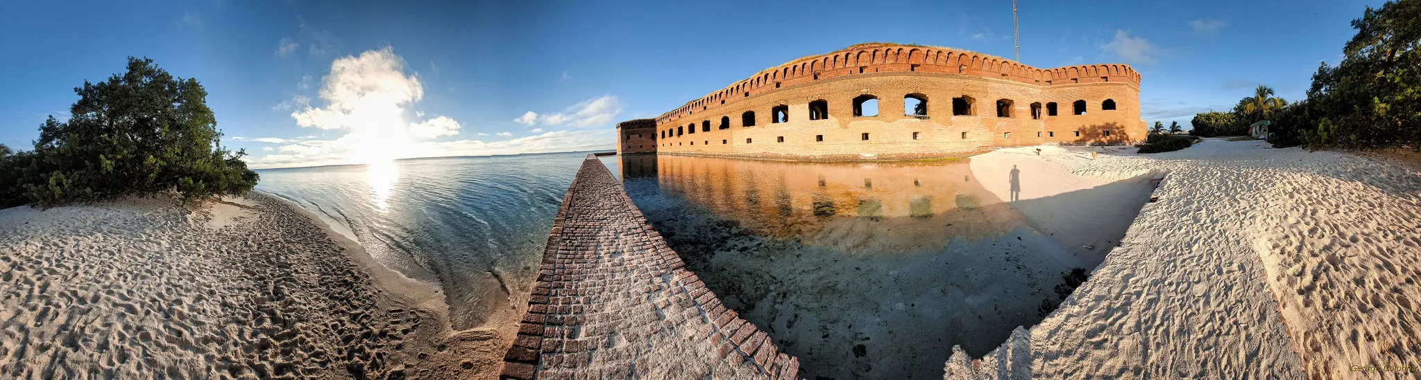 George Colonna
Maryland, United States
12 work samples
Started flying drones for General Dynamics Robotics Systems in 2009 as the subject matter expert and lead test engineer for RCTA and a program called the Soldier Machine Interface. We developed leader/follower code for up-armored autonomous assets a full decade before Google fielded their driverless car "train" and a UI that let soldiers/marines plan missions on the ground and in the air. My job was to ensure the software worked, more importantly, met customer requirements. Working in the field afforded me a wealth of experience regarding process and implementation, but also how to think critically and resolve issues on the fly. If interested in learning more about my credentials, please see my website. My current fleet is primarily DJI and Autel. I have RTK capability and a complete field kit to sustain remote operations for several days.
InspectionMapping / surveyConstructionOtherFilm / TV Tanner Scholten
Washington, United States
10 work samples
I am a professional photographer and commercial remote pilot (FAA Part 107) based in Kirkland, serving Western Washington and beyond (including most of Washington, and Oregon as needed). By pairing my skills as a photographer with the unique data types and perspectives of aerial capture, I bridge the gap between technical data collection and polished visuals. My flight experience centers on technical aerial data—including multi-site agricultural monitoring and extensive, high-resolution orthomosaic mapping—alongside clean, publication-grade commercial real estate and event media.
Mapping / surveyReal estateEventWeddingConstructionAgricultureOther- K Enagonio

Tennessee, United States
10 work samples
I've been flying since 2015 and specialize in both cinematic filmmaking as well as surveying, construction, sensitive infrastructure capture, and music videos and events.
Film / TVConstructionInspectionEventAgricultureReal estateMapping / surveyOther
Construction pilots by state
Choosing a cadence
Monthly suits most projects and is by far the most common choice: it is frequent enough to show meaningful change and infrequent enough not to become an administrative task. Fortnightly earns its place during periods of rapid visible change — superstructure going up, envelope going on — and daily or weekly capture is generally reserved for a specific reason, such as a critical sequence or an active dispute. Milestone-based capture is the other sensible pattern: fly at foundation, at topping out, at envelope completion and at handover, which produces fewer, more meaningful sets. Whatever you pick, book the whole run at once rather than job by job — it is cheaper, and it means the same pilot flies the same pattern rather than a different one each month.
Setting up the first flight properly
The first visit is worth more attention than the rest put together, because everything after it is a repeat. Walk or map the positions you want: the classic set is four obliques from the corners at a fixed altitude, one nadir over the centre, and any specific views your client or lender asks for. Record the coordinates, altitudes and headings so any pilot can reproduce them. Decide the deliverable — stills, a short edited clip, a nadir orthomosaic, or all three — and the file naming, because twelve months of consistently named folders is a usable archive and twelve months of inconsistent ones is not. If the project has a marketing use as well as a record-keeping one, say so up front; the shots are different and it is cheaper to capture both on the same visit.
Who actually uses the imagery
More people than commission it, which is worth knowing when you scope. Project managers use it for progress reporting and for the monthly report pack. Owners and lenders use it as independent verification that the draw request matches the site. Marketing wants the hero shots, and will ask for them at handover whether or not anyone planned for it. Safety uses it to look at site layout, access routes and where plant is positioned. And claims and delay analysis use it after the fact, which is the use nobody budgets for and everybody is glad of. A single monthly flight can serve all of these if the brief covers them; retrofitting a use in month nine cannot recover month one.
Site logistics, briefly
Expect to arrange induction, PPE and a launch and recovery area clear of the crane's slew radius and of active lifts. Timing is a real constraint: concrete pours, deliveries and lifts all compete with the flight, and a slot agreed in advance beats a pilot standing around. If the site sits under controlled airspace, an FAA authorisation is needed and has a lead time, so a recurring booking should have that sorted once rather than monthly. Flying over people who are not part of the operation is restricted, which on an active site usually means coordinating a brief window rather than clearing the whole place.
Common questions
How much do drone progress photos cost?
Recurring capture is priced per visit, and the rate drops with the length of the commitment — a twelve-month monthly booking is quoted differently from a single flight. Construction quotes on SkyLog have been too few to publish a meaningful range, so rather than invent one: post the project with the cadence and duration and compare real quotes, which costs nothing.
How often should we fly?
Monthly is the default and suits most projects. Go fortnightly during periods of rapid visible change, and consider milestone-based capture if the programme has clear stages. What matters more than frequency is that it is regular and that the flights are identical.
Can we get the same shots every month?
Yes, and you should insist on it. Fix the positions, altitudes and headings on the first visit and record them so any pilot can reproduce them. Consistent framing is what turns a photo set into a time series.
Do we need the same pilot each time?
It helps — they know the site, the access and the constraints — but it should not be a dependency. If the vantage points are documented properly, a substitute can fly them. Ask for that documentation as a deliverable rather than assuming it exists.
Can the same flight produce a site map?
Often yes. A nadir grid flown for an orthomosaic is a different pattern from oblique progress stills, but both can usually be done in one mobilisation. Ask for it when you scope, because it changes the flight plan and the processing.
What happens to the imagery when the project ends?
Whatever you agreed at the start, so agree it at the start. Settle ownership, delivery format and how long the pilot retains files before the first flight, not at handover when you need the archive.
Related drone services
Set up progress capture free
Post the project with its cadence and duration. Pilots quote per visit, and we take no commission.
- No commission, ever
- Part 107 certified pilots
- No obligation to hire
Prices and guidance on this page were last reviewed .