Drone Stockpile Volume Measurement
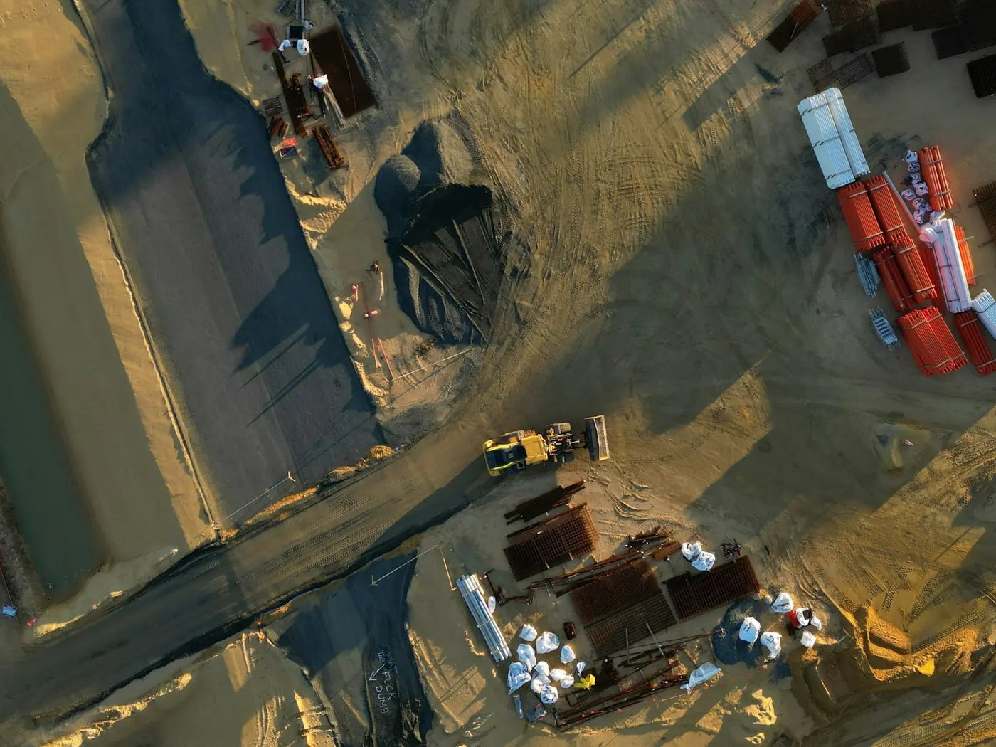
Measuring a pile by walking it with a GPS rover takes hours and interpolates everything between the points you walked. A drone captures the whole surface, which is both faster and, on an awkward pile, more honest about its shape.
- Free to post
- No commission on the job
- Part 107 certified pilots


110 construction pilots ready to quoteAcross 36 states & regions
The whole surface, not a sample
Photogrammetry produces a dense surface model over the entire pile rather than a scatter of walked points with a surface fitted between them. On irregular piles that difference is the measurement, not a refinement of it.
A yard in an hour, not a day
Because it is quick, it can be done monthly instead of annually — and a stock figure you actually trust each month is worth considerably more than a precise one you get once a year.
Nobody climbing a pile
Walking stockpiles is one of the routine hazards in this industry, and a survey that does not require it removes a real risk rather than a theoretical one.
Free to post
Posting and receiving quotes costs nothing, and SkyLog takes no commission and adds no markup. You pay the pilot you hire, at the price the two of you agree.
What this settles
- Volume per pile, individually, computed between a surface model and a stated base.
- Accuracy within a few percent of a conventional survey, given proper ground control and visible pile toes.
- A surface model and point cloud you keep, so next month's survey can be differenced against this one and an auditor can re-derive the figure.
- Imagery of each pile — which is how you catch two piles that have merged, or material placed against a wall.
What it does not
- Give one answer. A fixed plane, a fitted toe surface and a pre-placement ground surface produce different volumes for the same pile, and none of them is wrong.
- See a toe that abuts a wall or another pile, which is where the uncertainty concentrates.
- Match fine dark material well — photogrammetry needs visual texture.
- Convert to tonnes safely. The bulk density assumption does that work, and it is where a good survey most often becomes a bad tonnage figure.
A report that does not state which base surface was used is not a report you can compare against next month's. Fix the definition once and reuse it.
How it works
Three steps, no account needed to start, and nothing to pay at any point in it.
- 1
Describe the job
The form opens with this page's answers already filled in — service, deliverable, site access. Add the location and anything specific to your site.
- 2
Pilots quote it
Every pilot whose service area and services match is notified. You get itemised quotes back with their credentials, kit and sample work attached.
- 3
Compare and hire
Pick on price, proximity or portfolio, and pay the pilot directly. SkyLog takes no cut and adds no markup to what you agree.
Construction pilots with published profiles
Real published profiles. Open any one to see credentials, kit, service area and sample work before you post.
 chris aldridge
Texas, United States
20 work samples
I’m a commercial drone pilot providing aerial mapping, property line overlays, topographic mapping, construction site data, radiometric thermal inspections, 3D modeling, real estate listing photography and video, property marketing, and professional aerial imagery for businesses and landowners.
Real estateWeddingEventInspectionMapping / surveyFilm / TVConstructionOther- George Benes

Oregon, United States
13 work samples
I've been a Part 107 drone pilot since 2019, working with Pacific Northwest clients on Real estate, construction progress, mapping, telecom inspections, architectural photography and events. I am very flexible and can provide deliverables within 24 - 48 hours. I take great pride in my work and having a photography business, my delivered photos are edited and culled to the best of the best. I worked for 30+ years as a commercial construction Superintendent, managing multi-million dollar construction projects and this experience allows me to be very safety oriented and knowledgeable on construction sites, providing the construction companies with usable deliverables that they can share with all stakeholders involved in their building project.
Real estateEventInspectionMapping / surveyConstruction  Andy Jones
California, United States
12 work samples
FAA Part 107 Certified Remote Pilot based in Southern California, specializing in construction documentation, infrastructure inspections, mapping, orthomosaics, and aerial imagery. With more than two decades of experience managing complex federal construction projects, I understand the importance of accuracy, safety, and delivering actionable data—not just photos. I operate professional DJI Enterprise aircraft, including the DJI Matrice 4E, DJI Matrice 4T, as well as the DJI Air 3S for high-resolution imaging and the DJI Neo 2 for specialized close-range operations. My services include construction progress documentation, roof and property inspections, land development, infrastructure photography, photogrammetry, mapping, and custom aerial imaging. I also conduct search operations for lost pets using aerial search techniques and thermal imaging. Every mission is conducted in compliance with FAA regulations, with careful mission planning, clear communication, and a commitment to delivering high-quality results on schedule. Whether you need a single inspection or recurring project documentation, my goal is to provide reliable aerial data you can confidently use to make decisions.
Real estateEventInspectionMapping / surveyConstructionAgricultureOtherFilm / TVWedding George Colonna
Maryland, United States
12 work samples
Started flying drones for General Dynamics Robotics Systems in 2009 as the subject matter expert and lead test engineer for RCTA and a program called the Soldier Machine Interface. We developed leader/follower code for up-armored autonomous assets a full decade before Google fielded their driverless car "train" and a UI that let soldiers/marines plan missions on the ground and in the air. My job was to ensure the software worked, more importantly, met customer requirements. Working in the field afforded me a wealth of experience regarding process and implementation, but also how to think critically and resolve issues on the fly. If interested in learning more about my credentials, please see my website. My current fleet is primarily DJI and Autel. I have RTK capability and a complete field kit to sustain remote operations for several days.
InspectionMapping / surveyConstructionOtherFilm / TV Tanner Scholten
Washington, United States
10 work samples
I am a professional photographer and commercial remote pilot (FAA Part 107) based in Kirkland, serving Western Washington and beyond (including most of Washington, and Oregon as needed). By pairing my skills as a photographer with the unique data types and perspectives of aerial capture, I bridge the gap between technical data collection and polished visuals. My flight experience centers on technical aerial data—including multi-site agricultural monitoring and extensive, high-resolution orthomosaic mapping—alongside clean, publication-grade commercial real estate and event media.
Mapping / surveyReal estateEventWeddingConstructionAgricultureOther- K Enagonio

Tennessee, United States
10 work samples
I've been flying since 2015 and specialize in both cinematic filmmaking as well as surveying, construction, sensitive infrastructure capture, and music videos and events.
Film / TVConstructionInspectionEventAgricultureReal estateMapping / surveyOther
Construction pilots by state
How the measurement is produced
The pilot flies a grid with high overlap, usually with obliques added so the sides of the piles are properly seen, and the images are processed into a dense point cloud and a surface model. Volume is then computed between that surface and a base — and the base is where the real decisions are. It can be a plane at a fixed elevation, a triangulated surface fitted to the toe of the pile, or a previously surveyed ground surface from before the material was placed. Those three give different answers for the same pile, and none of them is wrong; they are answers to slightly different questions. A report that does not state which base was used is not a report you can compare against next month's.
What accuracy is realistic
Well-executed drone volumetrics with proper ground control routinely land within a few percent of a conventional survey, and the residual difference is usually about the base surface rather than about the aerial capture. Accuracy depends on the ground control — an RTK or PPK aircraft, or checkpoints placed and shot, and ideally both — on the flight geometry, and on how visible the toe of each pile is. It degrades where piles abut walls or each other so the toe cannot be seen, on very fine dark material with little visual texture for photogrammetry to match, and in poor light. Vegetation and standing water are the other classic problems. If your figures feed financial reporting or an audit, ask what control was used and what check measurements were taken, because that is what makes the number defensible rather than merely precise.
Making the figures comparable over time
The point of a monthly survey is the comparison, and comparisons break when the method drifts. Fix the base surface definition and reuse it. Keep the same coordinate system, and state it. Place ground control in permanent positions if the site layout allows, so each survey is tied to the same frame. Ask for the surface model and point cloud as deliverables, not just a volume figure, so a later survey can be differenced against this one and so an auditor can re-derive the number. And record the material and its bulk density separately from the volume — converting cubic yards to tonnes is where a good survey most often turns into a bad tonnage figure, because the density assumption is doing the work.
What a report should contain
Volume per pile, individually, not as a site total. The base surface method, stated explicitly. The date and time of capture. The coordinate system and the control used, with residuals if checkpoints were shot. The surface model or point cloud in an exchangeable format. Visual imagery of each pile, which is how you catch the case where two piles have merged or where material has been placed against a wall. And any caveats about piles that could not be fully seen — a surveyor who flags an obscured toe is telling you where the uncertainty is, which is more useful than a clean number that hides it.
Common questions
How accurate is a drone stockpile survey?
With proper ground control, typically within a few percent of a conventional survey. The larger source of disagreement between two surveys of the same pile is usually the base surface definition rather than the capture, which is why the method has to be stated and kept constant.
How much does it cost?
It is quoted by site size and number of piles, and recurring monthly work is priced below one-off surveys. Construction quotes on SkyLog are too few so far to publish an honest range — post the site with the pile count and cadence and compare real quotes instead.
Do I need a licensed surveyor?
For internal stock control, usually not. If the figures support financial reporting, a regulatory submission or anything presented as a survey of record, check your jurisdiction: in most US states a deliverable presented as a survey must be signed by a licensed surveyor, and a drone pilot who is not one can capture the data but cannot certify it. Say up front if you need a stamp.
Can it measure material inside a shed or bunker?
Not from the air. Covered stock needs indoor scanning, which is a different specialism with different equipment. Say so when you post rather than discovering it on the day.
How often should we survey?
Monthly is common for active sites, quarterly where movement is slower, and many operations add a survey at financial year end. The economics changed when the survey stopped taking a day: frequency is now a choice rather than a budget constraint.
Can the same flight give us cut and fill?
Yes — the same surface model differenced against a design or a prior survey produces cut and fill. Ask for it when you scope, and supply the design surface in a format the pilot can use.
Related drone services
Post your stockpile survey free
Give the site, the number of piles and the cadence you want. Pilots quote directly, with no commission.
- No commission, ever
- Part 107 certified pilots
- No obligation to hire
Prices and guidance on this page were last reviewed .