Cell Tower Drone Inspection
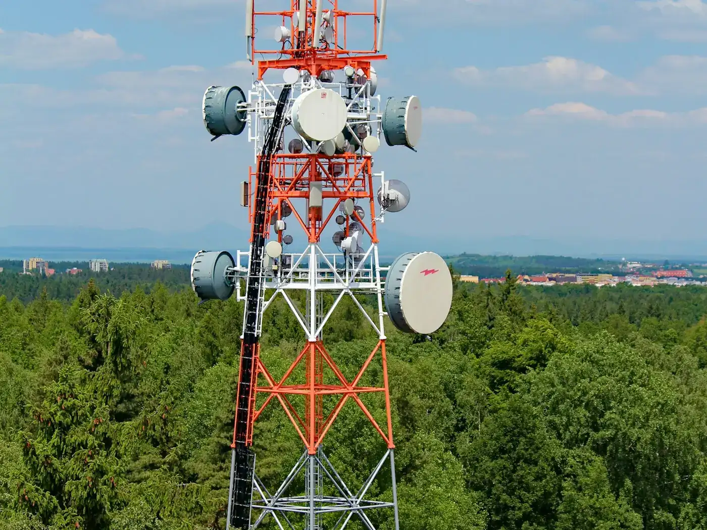
Tower climbing is among the more dangerous jobs in the country, and a large share of climbs were only ever to look at something. Removing those climbs is the clearest safety argument aerial inspection has in any sector.
- Free to post
- No commission on the job
- Part 107 certified pilots



117 inspection pilots ready to quoteAcross 37 states & regions
An audit without a climb
Mount positions, azimuths, antenna and radio models, cable routing and connector condition can all be documented from the air. The climb is then reserved for work that needs hands, not for finding out what is up there.
The safety case is the business case
Every climb carries risk that no procedure removes entirely. An inspection method that does not put anyone at height changes the risk register, and that is usually what gets these programmes approved.
A reusable asset record
A well-captured tower survey is not just this year's condition report — it is a photographic asset register that the next colocation application, structural analysis or maintenance visit starts from.
Free to post
Posting and receiving quotes costs nothing, and SkyLog takes no commission and adds no markup. You pay the pilot you hire, at the price the two of you agree.
What this settles
- Structural condition: members, welds, bolts and connections, corrosion and coating breakdown, guy wires, anchors and terminations.
- The appurtenance inventory — every mount and its position, each antenna and radio with model visible, azimuths, downtilts and mount alignment.
- Coax, fibre and grounding routing and condition; obstruction lighting, climbing facilities and signage.
- The compound: shelter and cabinet exteriors, fencing and access.
What it does not
- Do anything requiring contact — bolt torque, thickness measurement or grounding resistance testing.
- Constitute a structural analysis. It supplies the condition evidence an engineer works from; their judgement is a separate product.
- Get on site quickly. Secured compounds bring permitting, escort and notification that routinely take longer than the inspection.
- Ignore RF. A live site radiates, and crew exposure rules mean carrier coordination and occasionally a power-down.
The failure mode is a folder of nice photographs nobody can index. Ask for imagery organised by elevation and azimuth, at consistent heights, so this survey can be compared with the next.
How it works
Three steps, no account needed to start, and nothing to pay at any point in it.
- 1
Describe the job
The form opens with this page's answers already filled in — service, deliverable, site access. Add the location and anything specific to your site.
- 2
Pilots quote it
Every pilot whose service area and services match is notified. You get itemised quotes back with their credentials, kit and sample work attached.
- 3
Compare and hire
Pick on price, proximity or portfolio, and pay the pilot directly. SkyLog takes no cut and adds no markup to what you agree.
Pilots who list tower and telecom work
Real published profiles. Open any one to see credentials, kit, service area and sample work before you post.
- George Benes

Oregon, United States
13 work samples
I've been a Part 107 drone pilot since 2019, working with Pacific Northwest clients on Real estate, construction progress, mapping, telecom inspections, architectural photography and events. I am very flexible and can provide deliverables within 24 - 48 hours. I take great pride in my work and having a photography business, my delivered photos are edited and culled to the best of the best. I worked for 30+ years as a commercial construction Superintendent, managing multi-million dollar construction projects and this experience allows me to be very safety oriented and knowledgeable on construction sites, providing the construction companies with usable deliverables that they can share with all stakeholders involved in their building project.
Real estateEventInspectionMapping / surveyConstruction - Jeff Weidner

North Carolina, United States
6 work samples
Popmix Media provides professional drone and ground photography, videography, and visual documentation services for businesses that need accurate, high quality imagery. From telecom infrastructure and commercial developments to construction projects, real estate, and advertising, we deliver the visuals that help companies inspect, market, document, and promote their assets. Air 3S Matrice 4E T50 Agras
Real estateInspectionMapping / surveyEventConstruction - JDJohn Daily
Minnesota, United States
3 work samples
Experienced highly in telecom inspections. Also conducts building inspections, roof inspections, pavement inspections, mapping, real estate photography, and 3D scanning. I have 2-Mavic 3 Enterprises, Matterport Pro 3, Insta360 X4, Gopro 360 MAX, Gopro Hero 10, DRTK-2 base station, a camper for long term site projects, an in vehicle/tent setup for short term projects, I also have a contractor that assists as a visual observer and ground work contractor.
Real estateInspectionMapping / surveyConstructionAgriculture  chris aldridge
Texas, United States
20 work samples
I’m a commercial drone pilot providing aerial mapping, property line overlays, topographic mapping, construction site data, radiometric thermal inspections, 3D modeling, real estate listing photography and video, property marketing, and professional aerial imagery for businesses and landowners.
Real estateWeddingEventInspectionMapping / surveyFilm / TVConstructionOther Andy Jones
California, United States
12 work samples
FAA Part 107 Certified Remote Pilot based in Southern California, specializing in construction documentation, infrastructure inspections, mapping, orthomosaics, and aerial imagery. With more than two decades of experience managing complex federal construction projects, I understand the importance of accuracy, safety, and delivering actionable data—not just photos. I operate professional DJI Enterprise aircraft, including the DJI Matrice 4E, DJI Matrice 4T, as well as the DJI Air 3S for high-resolution imaging and the DJI Neo 2 for specialized close-range operations. My services include construction progress documentation, roof and property inspections, land development, infrastructure photography, photogrammetry, mapping, and custom aerial imaging. I also conduct search operations for lost pets using aerial search techniques and thermal imaging. Every mission is conducted in compliance with FAA regulations, with careful mission planning, clear communication, and a commitment to delivering high-quality results on schedule. Whether you need a single inspection or recurring project documentation, my goal is to provide reliable aerial data you can confidently use to make decisions.
Real estateEventInspectionMapping / surveyConstructionAgricultureOtherFilm / TVWedding George Colonna
Maryland, United States
12 work samples
Started flying drones for General Dynamics Robotics Systems in 2009 as the subject matter expert and lead test engineer for RCTA and a program called the Soldier Machine Interface. We developed leader/follower code for up-armored autonomous assets a full decade before Google fielded their driverless car "train" and a UI that let soldiers/marines plan missions on the ground and in the air. My job was to ensure the software worked, more importantly, met customer requirements. Working in the field afforded me a wealth of experience regarding process and implementation, but also how to think critically and resolve issues on the fly. If interested in learning more about my credentials, please see my website. My current fleet is primarily DJI and Autel. I have RTK capability and a complete field kit to sustain remote operations for several days.
InspectionMapping / surveyConstructionOtherFilm / TV
Inspection pilots by state
What a tower inspection captures
Structural condition first: the state of members, welds, bolts and connections, corrosion and coating breakdown, and the condition of guy wires, anchors and their terminations on guyed structures. Then the appurtenances, which is usually the commercial reason for the survey: every mount and its position on the structure, each antenna and radio with its model visible where possible, azimuths and downtilts, mount alignment, and the routing and condition of coax, fibre and grounding. Then the safety and compliance items — obstruction lighting, climbing facilities, signage and grounding at the base. And finally the site itself: compound condition, shelter and cabinet exteriors, fencing and access.
Getting a package your engineer can actually use
The failure mode here is a folder of nice photographs that nobody can index. Ask for imagery organised by elevation and by azimuth so any given appurtenance can be found without scrolling through everything. Ask for consistent capture heights so this survey can be compared with the next. If the survey feeds a structural analysis or a colocation application, ask what that process needs before the flight rather than after — a mount photographed from one angle when the engineer needed three is a second mobilisation. A photogrammetric model of the tower is increasingly asked for, since it lets someone measure positions and heights afterwards, but it needs a denser capture and should be specified up front.
Airspace, RF and site access
Three constraints, and they are not the ones people expect. Airspace: towers are tall by definition and often sit near airports, so controlled airspace authorisation is common rather than exceptional. RF: a live site radiates, and while the aircraft is generally not the concern, the crew's exposure and the operator's own safety rules are — sites frequently require coordination with the carrier and occasionally a power-down, and that is a scheduling matter, not a flying one. Access: most towers are on secured compounds with their own permitting, escort and notification requirements, and the paperwork routinely takes longer than the inspection. A pilot experienced in this sector will ask about all three at quote stage.
What it does not replace
Anything requiring contact. Bolt torque, thickness measurement, grounding resistance testing and any hands-on structural assessment still need someone on the structure or on the ground with instruments. Aerial inspection is also not a structural analysis: it supplies the condition evidence and the appurtenance inventory that a structural engineer works from, and the engineer's judgement is a separate product from the imagery. Where it saves money is in reducing how often a climb is needed and in making the climbs that do happen better targeted.
Common questions
How much does a drone tower inspection cost?
It varies with tower height, how much appurtenance detail is required, and site access. Inspection quotes on SkyLog have ranged from $100 to about $1,550 with a $300 median across 13 quotes spanning all inspection types — a tower audit sits above the middle of that. Post the tower and get real numbers.
Does the site need to be powered down?
Frequently not, but it depends on the carrier's own RF safety rules rather than on aviation rules. Raise it early: it is a coordination question with the site owner and it drives the schedule more than the flying does.
Can a drone read antenna model numbers?
Often, with a zoom payload and reasonable conditions. It is worth asking for explicitly if the survey is an asset audit rather than a condition check, because it changes the payload and the standoff distance.
Can we get azimuths and downtilts?
Yes, and this is one of the main reasons these surveys are commissioned. Accuracy depends on the method — measured from a photogrammetric model is more defensible than estimated from a photograph — so ask which you are getting.
Does this satisfy a structural inspection requirement?
Not by itself. It supplies condition evidence and inventory; whether that meets a particular standard or contractual requirement is a question for the engineer who signs the assessment. Ask them what they need before commissioning.
Can one visit cover several towers?
Yes, and it is much cheaper per tower that way. Post the portfolio rather than a single site — pilots price a route of several structures very differently from one.
Related drone services
Post your tower inspection free
One tower or a portfolio. Give the heights, the scope and the access constraints, and pilots will quote directly.
- No commission, ever
- Part 107 certified pilots
- No obligation to hire
Prices and guidance on this page were last reviewed .