Drone Quarry & Mine Survey
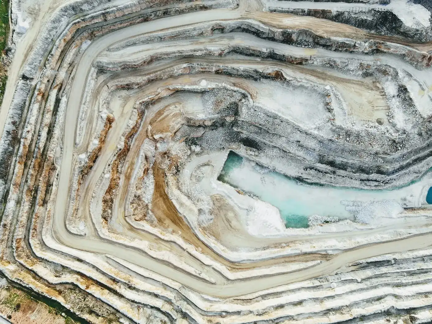
A working pit changes shape every week, and the survey that describes it is usually months old. Flying it is quick enough that the plan and the ground can actually agree with each other.
- Free to post
- No commission on the job
- Part 107 certified pilots

82 mapping / survey pilots ready to quoteAcross 32 states & regions
Pit progression against plan
A surface model each month, differenced against the last and against the design, shows exactly how much has come out and whether extraction is following the plan — which is the question the site manager and the regulator both ask.
Highwalls without standing under them
The face is the most hazardous part of a quarry and the part most in need of looking at. Photographing and modelling it from the air puts nobody at the toe.
Stock figures you can trust monthly
Product stock measured properly every month rather than estimated all year is a materially different number at year end, and it is the one the auditors ask about.
Free to post
Posting and receiving quotes costs nothing, and SkyLog takes no commission and adds no markup. You pay the pilot you hire, at the price the two of you agree.
What this settles
- Pit progression as a surface each cycle, differenced against the last and against the extraction plan.
- Highwall geometry — face angles, bench widths, catch bench capacity, crest and toe against design — plus condition and tension cracking.
- Stockpiles measured individually, haul road width and gradient, water management, and proximity of extraction to boundaries.
- Checkpoint residuals in every report, which is what makes a stock valuation figure defensible.
What it does not
- Certify a survey of record. Statutory obligations generally require a licensed or qualified mine surveyor to sign, and that is about credentials, not equipment.
- Survive disposable ground control. Targets get buried, driven over and blasted, so control has to be permanent and outside the working area.
- Produce comparable numbers if the survey floats relative to the last one — the volume change is then noise.
- Ignore the site's regime: induction, PPE, traffic management around haul roads, and blasting schedules that shut the site down.
Be explicit in the post about whether you need a statutory survey or an internal one. It determines who can take the job, and it is an unpleasant thing to discover after delivery.
How it works
Three steps, no account needed to start, and nothing to pay at any point in it.
- 1
Describe the job
The form opens with this page's answers already filled in — service, deliverable, site access. Add the location and anything specific to your site.
- 2
Pilots quote it
Every pilot whose service area and services match is notified. You get itemised quotes back with their credentials, kit and sample work attached.
- 3
Compare and hire
Pick on price, proximity or portfolio, and pay the pilot directly. SkyLog takes no cut and adds no markup to what you agree.
Mapping and survey pilots with published profiles
Real published profiles. Open any one to see credentials, kit, service area and sample work before you post.
 chris aldridge
Texas, United States
20 work samples
I’m a commercial drone pilot providing aerial mapping, property line overlays, topographic mapping, construction site data, radiometric thermal inspections, 3D modeling, real estate listing photography and video, property marketing, and professional aerial imagery for businesses and landowners.
Real estateWeddingEventInspectionMapping / surveyFilm / TVConstructionOther- George Benes

Oregon, United States
13 work samples
I've been a Part 107 drone pilot since 2019, working with Pacific Northwest clients on Real estate, construction progress, mapping, telecom inspections, architectural photography and events. I am very flexible and can provide deliverables within 24 - 48 hours. I take great pride in my work and having a photography business, my delivered photos are edited and culled to the best of the best. I worked for 30+ years as a commercial construction Superintendent, managing multi-million dollar construction projects and this experience allows me to be very safety oriented and knowledgeable on construction sites, providing the construction companies with usable deliverables that they can share with all stakeholders involved in their building project.
Real estateEventInspectionMapping / surveyConstruction  Andy Jones
California, United States
12 work samples
FAA Part 107 Certified Remote Pilot based in Southern California, specializing in construction documentation, infrastructure inspections, mapping, orthomosaics, and aerial imagery. With more than two decades of experience managing complex federal construction projects, I understand the importance of accuracy, safety, and delivering actionable data—not just photos. I operate professional DJI Enterprise aircraft, including the DJI Matrice 4E, DJI Matrice 4T, as well as the DJI Air 3S for high-resolution imaging and the DJI Neo 2 for specialized close-range operations. My services include construction progress documentation, roof and property inspections, land development, infrastructure photography, photogrammetry, mapping, and custom aerial imaging. I also conduct search operations for lost pets using aerial search techniques and thermal imaging. Every mission is conducted in compliance with FAA regulations, with careful mission planning, clear communication, and a commitment to delivering high-quality results on schedule. Whether you need a single inspection or recurring project documentation, my goal is to provide reliable aerial data you can confidently use to make decisions.
Real estateEventInspectionMapping / surveyConstructionAgricultureOtherFilm / TVWedding George Colonna
Maryland, United States
12 work samples
Started flying drones for General Dynamics Robotics Systems in 2009 as the subject matter expert and lead test engineer for RCTA and a program called the Soldier Machine Interface. We developed leader/follower code for up-armored autonomous assets a full decade before Google fielded their driverless car "train" and a UI that let soldiers/marines plan missions on the ground and in the air. My job was to ensure the software worked, more importantly, met customer requirements. Working in the field afforded me a wealth of experience regarding process and implementation, but also how to think critically and resolve issues on the fly. If interested in learning more about my credentials, please see my website. My current fleet is primarily DJI and Autel. I have RTK capability and a complete field kit to sustain remote operations for several days.
InspectionMapping / surveyConstructionOtherFilm / TV Tanner Scholten
Washington, United States
10 work samples
I am a professional photographer and commercial remote pilot (FAA Part 107) based in Kirkland, serving Western Washington and beyond (including most of Washington, and Oregon as needed). By pairing my skills as a photographer with the unique data types and perspectives of aerial capture, I bridge the gap between technical data collection and polished visuals. My flight experience centers on technical aerial data—including multi-site agricultural monitoring and extensive, high-resolution orthomosaic mapping—alongside clean, publication-grade commercial real estate and event media.
Mapping / surveyReal estateEventWeddingConstructionAgricultureOther- K Enagonio

Tennessee, United States
10 work samples
I've been flying since 2015 and specialize in both cinematic filmmaking as well as surveying, construction, sensitive infrastructure capture, and music videos and events.
Film / TVConstructionInspectionEventAgricultureReal estateMapping / surveyOther
Mapping pilots by state
What gets measured
Pit progression: a surface of the working area each cycle, differenced against the previous survey to give material moved, and against the extraction plan to show compliance. Product stockpiles, measured individually — see the dedicated stockpile page for how the base surface choice drives that number. Highwall geometry: face angles, bench widths and heights, catch bench capacity, and crest and toe positions against design. Highwall condition: loose material, cracking, tension cracks at the crest, evidence of movement, and areas of scaling needed. Haul roads: width, gradient and condition. Water management: sumps, ponds and drainage. Site boundaries and buffer zones, and how close extraction is to them. And the restoration and overburden areas, which is where a regulator's interest often sits.
Accuracy and control on a working site
The same rules as any survey apply, with one complication: a quarry destroys ground control. Targets get buried, driven over and blasted, so the practical approach is permanent control established once in stable ground outside the working area, tied to your site coordinate system, and re-used every survey. That is what makes successive surveys differenceable, which is the entire point — an internally consistent survey that floats relative to the last one produces a volume change figure that is noise. An RTK or PPK aircraft reduces how many targets are needed and should be treated as a baseline rather than an upgrade on a site being surveyed monthly. Ask for checkpoint residuals in every report; on a site where the numbers feed stock valuation, an error statement is not optional.
Who is allowed to sign it
This matters more here than in most categories. Mining and quarrying are regulated, statutory survey obligations exist in most jurisdictions, and the person who signs a survey of record generally has to hold a licence or a mine surveyor qualification. A drone pilot can capture the data and produce the surfaces; whether they can certify the result is a question about their credentials, not their equipment. Plenty of the work here is internal — stock control, planning, progress — and needs no certification at all. Some of it is statutory and does. Be explicit in the post about which you need, because it determines who can take the job and it is an unpleasant thing to discover after delivery.
Safety and site rules
An operating quarry is a hazardous site with its own regime: induction, PPE, traffic management around haul roads, and blasting schedules that shut the site down entirely at intervals. Flights need coordinating with blasting and with plant movement, and a pilot walking to a launch point near a face is subject to the same rules as everyone else. Dust affects both visibility and equipment. Some sites restrict overflight of the plant area. None of this is unusual, and a pilot who has surveyed a working site will expect it — but the post should state the induction requirement and the blasting pattern, because those set the day.
Common questions
How accurate are the volumes?
With permanent control and an RTK or PPK aircraft, comparable to conventional survey — and the residual disagreement is usually about the base surface definition rather than the capture. Fix the method and keep it fixed, or successive surveys are not comparable.
Can a drone survey satisfy our statutory obligation?
Only if the person signing it holds the required licence or mine surveyor qualification. The aircraft is not the issue; the certification is. Say in the post whether you need a signed survey of record or internal figures.
How often should we fly?
Monthly is common on active sites for stock and progression, with additional surveys around year end or an audit. Once a survey takes a morning rather than a week, frequency stops being a budget question.
Can it survey the highwall safely?
Yes, and it is one of the strongest reasons to do it — face condition and geometry can be captured and modelled without anyone at the toe. Oblique capture is needed as well as nadir, so specify that the face is in scope.
What does it cost?
By site area and cadence, and a recurring monthly commitment prices well below repeated one-offs. Mapping quotes on SkyLog are too few so far to publish an honest range, so post the site with the cadence rather than working from an invented figure.
Will dust and blasting interfere?
Dust affects visibility and equipment, and blasting shuts the site. Both are scheduling matters — state the blasting pattern when you post and the survey gets planned around it.
Related drone services
Post your quarry survey free
Give the site area, what you need measured and the cadence. Say if the survey must be signed.
- No commission, ever
- Part 107 certified pilots
- No obligation to hire
Prices and guidance on this page were last reviewed .